SUBSURFACE UTILITY ENGINEERING SERVICES
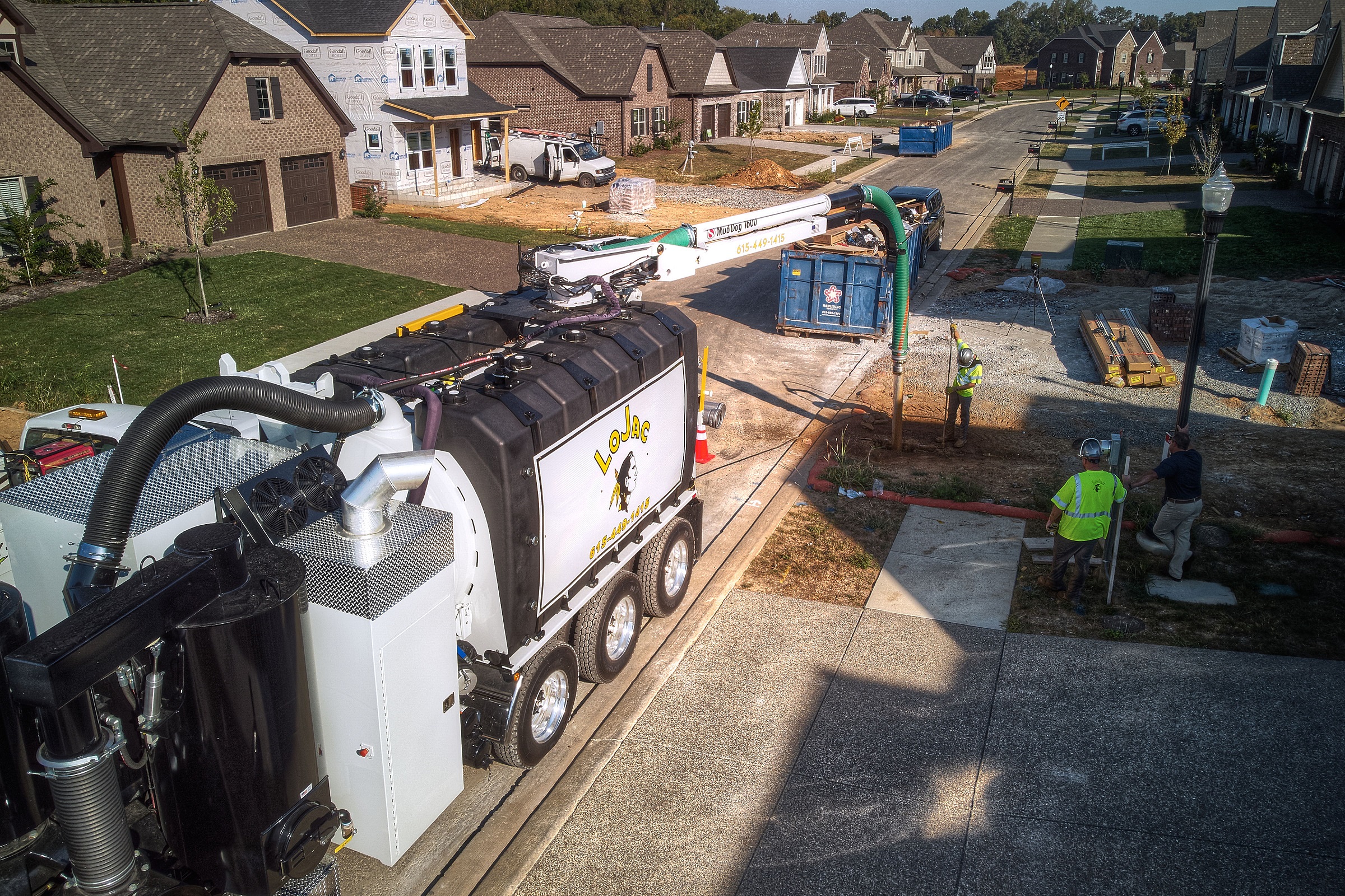
Subsurface utility engineering (S.U.E.) is a process of mapping utilities, including relocation, design, condition assessment, and communication of utility issues and cost estimates. LoJac uses vacuum excavation techniques to gather information needed for effective S.U.E. We can provide mapping for all quality levels defined by the American Society of Civil Engineers, depending on what exactly is needed for the particular project.
This type of work is primarily done at the early design stage of a project or for asset management. Early design work involves fully designing and implementing the utility system, while with asset management the client may not have a full map of the system and will need the subsurface utility engineering team to create such a map. LoJac is experienced in both forms of S.U.E.
Subsurface utility engineering refers to a branch of engineering that involves managing certain risks associated with utility mapping at appropriate quality levels, utility coordination, utility relocation design and coordination, utility condition assessment, communication of utility data to concerned parties, utility relocation cost estimates, implementation of utility accommodation policies, and utility design.
The Process of S.U.E. Services
The S.U.E. process begins with a work plan that outlines the scope of work, project schedule, levels of service vs. risk allocation, and desired delivery method. Non-destructive surface geophysical methods are then leveraged to determine the presence of subsurface utilities and to mark their horizontal position on the ground surface.
Vacuum excavation techniques are employed to expose and record the precise horizontal and vertical position of the assets. This information is then typically presented in CAD format or a GIS-compatible map.
A conflict matrix is also created to evaluate and compare collected utility information with project plans, identify conflicts, and propose solutions. The concept of S.U.E. is gaining popularity worldwide as a framework to mitigate costs associated with project redesign and construction delays and to avoid risk and liability that can result from damaged underground utilities.
In 2003, the American Society of Civil Engineers (ASCE) published Standard 38-02 titled Standard Guideline for the Collection and Depiction of Existing Subsurface Utility Data. The standard defined S.U.E. and set guidance for the collection and depiction of subsurface utility information. The ASCE standard presents a system to classify the quality of existing subsurface utility data, in accordance with four quality levels:
Quality Level D. QL-D is the most basic level of information for utility locations. It comes from existing utility records or verbal recollections. QL-D is useful primarily for project planning and route selection activities.
Quality Level C. QL-C involves surveying visible above-ground utility facilities (e.g., manholes, valve boxes, etc.) and correlating this information with existing utility records (QL-D information).
Quality Level B. QL-B involves the application of appropriate surface geophysical methods to determine the existence and horizontal position of virtually all subsurface utilities within a project's limits.
Quality Level A. QL-A, also known as "daylighting", is the highest level of accuracy presently available. It provides information for the precise plan and profiles mapping of underground utilities through the actual exposure of underground utilities (usually at a specific point). It also provides the type, size, condition, material, and other characteristics of underground features. Exposure is typically achieved through hand digging or Hydro-Vacuuming.
Subsurface utility engineering is mainly used at the design stage of a capital works project and when information is being collected for asset management purposes. In both situations, a similar process is followed but the scope of the work and presentation of the information may vary. When a S.U.E. investigation is carried out for a capital works project prior to construction, the objective is generally to collect accurate utility information within the project area to avoid conflict at the later stages of the project.
For initiatives involving asset management, project owners may be missing information about their underground utilities or have inaccurate data. In this situation, a subsurface utility engineering provider would collect the required information and add it to the asset management database, according to the four quality levels prescribed by ASCE Standard 38-02.
If you are in the search for subsurface utility engineering companies, please feel free to contact our team to learn more about how we can help you accomplish your needs.